‘Stay well back ... or risk certain death’: giant waves slam California coast
The San Francisco Bay Area was hit with giant waves on Dec. 17, after storm systems churned waters to dangerous levels along the West Coast.
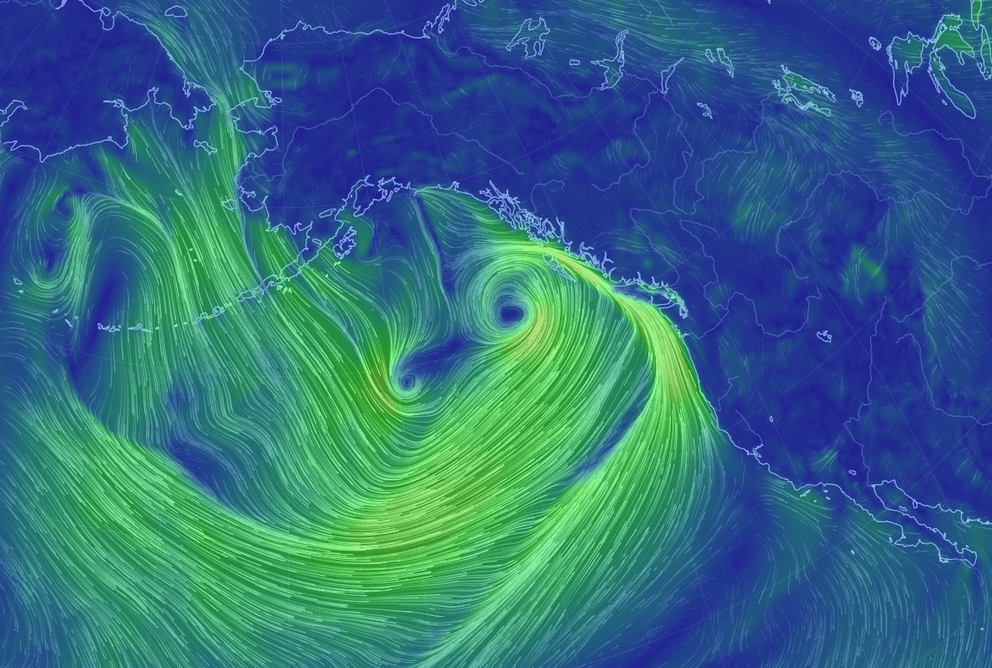
Storm systems, driven by persistent low pressure near Alaska, are churning waters to dangerous levels along the West Coast of the United States.
The focus of the punishment from massive waves is from southern Washington state through central California. The San Francisco Bay area is one region taking the brunt, with waves expected to reach 30 to 40 feet in height through Tuesday. It’s even been enough to postpone a surfing competition.
This event is huge, and truly affecting the whole West Coast. High surf warnings extend from north of the Oregon and Washington border to about a two-hour drive north of Los Angeles. High surf advisories or gale warnings stretch from the Canada to Mexico border.
“The dramatic wave heights are related to a consistent fetch of wind action that . . . has origins up near Alaska,” Marshall Shepherd, professor of atmospheric sciences at the University of Georgia, writes at Forbes.
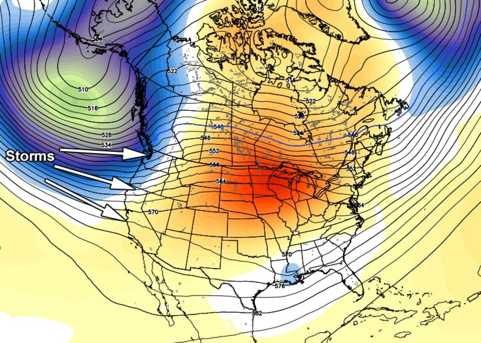 The prevailing pattern covering about a week and centered on today.
As can be seen in the image above (where blue is low pressure and orange is high pressure), the cause of the widespread and life-threatening breakers along the West Coast is this massive upper-level low-pressure complex spinning around the Gulf of Alaska.
The gigantic gyre is blasting storm after storm at the West Coast. It’s also fostering ideal conditions for strong winds to blow over hundreds of miles of ocean, virtually unaltered, which piles up mammoth waves in the process.
Expectations are for conditions so extreme that the National Weather Service in the San Francisco Bay tweeted, “STAY WELL BACK FROM THE OCEAN OR RISK CERTAIN DEATH.” The urgency highlights the unusual risk posed by this round of mega-swells.
Northern California, including the San Francisco Bay area, should end up with the worst of these pounding waves at the shoreline. The peak of the peak may be Monday, when waves in the 25- to 40-foot range could be common. Some could even exceed 50 feet, according to the Weather Service.
To the north of the Bay Area, wave heights in the 25- to 35-foot range are likely across the Northern California coast and into Oregon. Heights slowly trail off to the north, but coastal zones north into Washington state face the risk of widespread strong winds as well as rainy conditions.
From Los Angeles and to the south, the wave action is enough for surf advisories with predicted heights between about four and 10 feet to the border with Mexico. Heading north along the coast from the Los Angeles area, wave heights climb to 15 to 25 feet across central portions of the California coast.
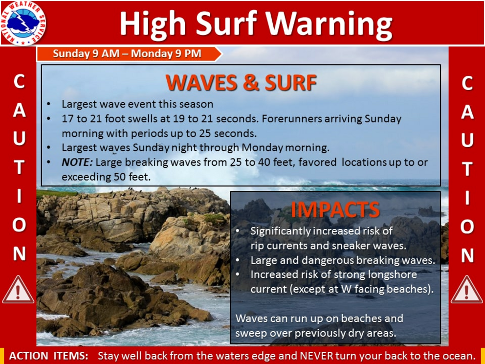 One of the many briefing slides currently highlighted by West Coast offices of the National Weather Service.
No major change in the pattern that is bringing this storminess ashore is expected in the short term, but the current intensity of the Alaskan low should wane in the days ahead. While large waves are likely for parts of the West Coast beyond Tuesday, the danger should be somewhat mitigated after that point.
For the rest of this article please go to source link below.
Video can be accessed at source link below.